g-Platform : Acquisition QC

g-Platform : Acquisition QC

Geomage From Israel

g-Platformโ„ข offers a seamless integration of interactive velocity analysis within its Stack Imaging module, equipping users with precise tools for generating accurate stacking velocities and enhanced data imaging. This innovative solution streamlines the workflow, ensuring optimal results in structural, geological, dynamic, and reservoir analysis for various applications.

Top g-Platform : Acquisition QC Alternatives
Ad StackScan

StackScan

Unlock deep insights into website technologies with StackScan, tracking 50,000+ tools (450+ technology categories to explore).

StackScan Pte Ltd
1 g-Platform : Time

g-Platform : Time

The g-Platform: Time utilizes Kirchhoff PreStack Time Migration (KPSTM) to deliver precise imaging of complex geological structures with gentle velocity gradients. Enhanced by MultiFocusing technology, it efficiently processes large datasets, leveraging full cluster capabilities and NVIDIAยฎ GPUs for optimized performance, ensuring accurate and AVO-friendly time migration results.

Geomage From Israel
1 vote
2 g-Space

g-Space

g-Spaceโ„ข is an innovative software solution designed for structural, geological, and geophysical interpretation. It facilitates seamless integration of seismic and well data, enabling users to perform horizon and fault picking, geological modeling, and dynamic updates. The software also supports well correlation, mis-tie workflows, and volumetric calculations for enhanced analysis.

Geomage From Israel
3 votes
3 g-Viewer

g-Viewer

g-Viewer enhances seismic data analysis by allowing users to visualize and select diverse datasets within a 3D scene. This commercial software supports plotting 2D sections and 3D volumes, facilitates multiple Seg-Y file integration, and offers features such as trace header representation, cross-plotting, and customizable editing options for improved data quality control.

Geomage From Israel
1 vote
4 Geotechnical Engineering Modelling Software (GEMS)

Geotechnical Engineering Modelling Software (GEMS)

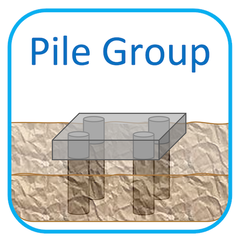
Geotechnical Engineering Modelling Software (GEMS) offers advanced CAD solutions for foundation analysis and design, employing cutting-edge finite element modeling techniques. Users can analyze various foundation types, including beam and pile foundations, through a cloud-based platform or downloadable versions for Windows and macOS. A free trial allows engineers to evaluate its capabilities effortlessly.

Geotechnical Engineering Modelling Software (GEMS) From India
5 GPT GES

GPT GES

GPT GES is a specialized geology and seismic software designed for advanced reservoir modeling. It effectively integrates structural and property modeling techniques, enabling users to analyze lithological structures, porosity, permeability, and oil saturation. This software enhances the accuracy of reservoir simulations, crucial for optimizing oil extraction strategies in complex geological settings like Block H125.

GPT From China
6 Geophysics by SeisWare

Geophysics by SeisWare

Geophysics by SeisWare offers a powerful seismic interpretation solution designed for efficiency and ease of use. With integrated 2D and 3D mapping tools, users can seamlessly analyze and share seismic data, enhancing collaboration across asset teams. The intuitive interface minimizes learning time, allowing geophysicists to focus on results rather than software complexities.

SeisWare From Canada
7 GravitasEDGE

GravitasEDGE

GravitasEDGE revolutionizes operational geology software by leveraging cloud technology to enhance collaboration and efficiency in well management. It features industry-leading applications like Winlog and PoreView for advanced log analysis and reporting. The innovative mobile app enables real-time access to crucial data, empowering users to streamline workflows across multiple disciplines throughout the well lifecycle.

HRH Geology From United Kingdom
8 Geology by SeisWare

Geology by SeisWare

Geology by SeisWare transforms geological workflows with its intuitive interface and powerful features. It facilitates real-time collaboration among teams, enabling seamless integration of geoscience data. Users can effortlessly perform petrophysical analyses, create custom workflows, and generate accurate visualizations, ensuring stakeholders receive clear insights for informed decision-making in geological projects.

SeisWare From United States
9 Katalyst

Katalyst

Katalyst specializes in transforming aging hard copy seismic sections into digital formats for the oil and gas sector. Utilizing proprietary software and over 25 years of expertise, Katalyst efficiently converts historical data to digital SEGY, enhancing seismic coverage in underexplored areas and supporting future processing and interpretation efforts.

Katalyst Data Management From Canada
10 Geobank

Geobank

Geobank empowers professionals to manage geoscientific information with state-of-the-art data management and in-field collection technologies. By ensuring a secure environment, it protects sensitive resource data, streamlining workflows and enhancing decision-making. Users benefit from structured, customizable outputs, reducing errors and fostering confidence while developing valuable ore-body knowledge for actionable insights.

Mitrais From Singapore
11 Kinemetrics PSD

Kinemetrics PSD

Kinemetrics PSD is a Windows application designed for efficient seismological data processing. It enables users to evaluate the quality of acquired data in the field, read various versions of event (.EVT) files, and conduct frequency analysis. Key features include calculating the Signal/Noise Ratio and Power Spectral Density, with customizable parameters for optimal analysis.

Kinemetrics From United States
12 Genesis Campaign Builder

Genesis Campaign Builder

Genesis Campaign Builder is an advanced geology and seismic software that empowers users to effectively plan and monitor multi-well drilling campaigns. By utilizing historical data and statistical analysis, it provides accurate forecasts for time and cost, enabling teams to identify risks early and optimize operational performance throughout the drilling process.

Genesis Petroleum Technologies From Australia
13 LEAMAP

LEAMAP

LEAMAP facilitates the conversion of hard-copy seismic maps into digital formats, enabling efficient data import and editing across over 60 raster file types. With tools like Locdig for digitizing basemaps and Locconv for flexible data import, this software streamlines seismic data preparation for interpretation workstations and further processing.

Lynx Information Systems From United Kingdom
14 Galaxy 4D

Galaxy 4D

Galaxy 4D offers geologists and reservoir engineers a powerful 2D/3D modeling tool that streamlines the creation and management of reservoir models. By enabling quick updates and facilitating a deeper understanding of reservoirs, it enhances the design of field development programs while minimizing risks. Its intuitive workflow and interactive modules allow for efficient analysis of saturation distribution, geological data, and reservoir properties across multiple wells.

Plano Research Corp From United States
15 LEASSV

LEASSV

LEASSV Seismic Vectorizing Software expertly re-vectorizes scanned seismic images, transforming them into industry-standard SEG-Y format trace files. With utilities for distortion calibration and advanced processing options, including Traceprep and Tracefix, it ensures high-quality seismic data preparation. Compatible with various raster formats, itโ€™s optimized for use with Contex scanners.

Lynx Information Systems From United Kingdom

Company Information

  • Company: Geomage
  • Country: Israel

Top g-Platform : Acquisition QC Features

  • Interactive velocity analysis
  • Fully integrated stack imaging
  • Accurate stacking velocity tools
  • Real-time data processing
  • User-friendly graphical interface
  • Detailed seismic data interpretation
  • Multi-dimensional VSP processing
  • Streamlined workflow automation
  • Comprehensive geological modeling
  • Dynamic reservoir characterization
  • Customizable visualization options
  • Enhanced data quality assurance
  • Seamless data integration capabilities
  • Built-in reporting features
  • Advanced anomaly detection algorithms
  • Support for varied seismic geometries
  • Collaborative project management tools
  • Historical data comparison functionality
  • Flexible licensing options
  • Robust technical support services